Selangkah Lagi Anda Menuju Gerbang Kesuksesan, SEGERA KLIK...!

Bukittinggi City

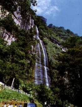
Bukittinggi (Indonesian for "high hill") is one of the larger cities in West Sumatra, Indonesia, with a population of over 91,000 people and an area of 25.24 km². It is situated in the Minangkabau highlands, 90 km by road from the West Sumatran capital city of Padang. It is located at [show location on an interactive map] 0°18′20″S, 100°22′9″E, near the volcanoes Mount Singgalang (inactive) and Mount Marapi (still active). At 930 m above sea level, the city has a cool climate with temperatures between 16.1°-24.9°C.


The city has its origins in five villages which served as the basis for a marketplace. The city was known as Fort de Kock during colonial times in reference to the Dutch outpost established here in 1825 during the Padri War. The fort was founded by Captain Bauer at the top of Jirek hill and later named after the then Lieutenant Governor-General of the Dutch East Indies, Hendrik Merkus de Kock. The first road connecting the region with the west coast was built between 1833 and 1841 via the Anai Gorge, easing troop movements, cutting the costs of transportation and providing an economic stimulus for the agricultural economy. In 1856 a teacher-training college (Kweekschool) was founded in the city, the first in Sumatra, as part of a policy to provide educational opportunities to the indigenous population. A rail line connecting the city with Payakumbuh and Padang was constructed between 1891 and 1894.

During the Japanese occupation of Indonesia in World War II, the city was the headquarters for the Japanese 25th Army, the force which occupied Sumatra. The headquarters was moved to the city in April 1943 from Singapore, and remained until the Japanese surrender in August 1945.


Klik disini untuk melanjutkan »»

Jam Gadang

Jam Gadang (literally "Massive Clock") is a clocktower and major landmark of the city of Bukittinggi, West Sumatra, Indonesia. It is located in the centre of the city, near the the main market, Pasar Atas, and is a tourist attraction.

The structure was build in 1926 during the Dutch colonial era, as a gift from the Queen to city's controleur. It was designed by architects Yazin and Sutan Gigi Ameh. Originally a rooster figure was placed on the apex, but it was changed into a Jinja-like ornament during the Japanese occupation of Indonesia. Following Indonesian independence, it was reshaped to its present form resembling traditional Minangkabaun roofs (Rumah gadang). It is said to have cost 3,000 Guilder.

The clock's diameter is 80 centimeters, the base's dimension is 13 metres in length and 4 metres wide, and it stands 26 metres tall.

One unique feature of the clock is that it uses the IIII for the number 4 instead of its traditional Roman Number IV.

Given its iconic appearance, the structure is a frequent object of local souvenirs. It is imprinted on apparels, painted, used as a sculpting model, and so forth. As of January 2008 it cost 50000 rupiahs (around US$ 5) to enter the tower.

Its plaza usually serves as the centre of New Year celebration in Bukittinggi for thousands of visitors to the city.

Klik disini untuk melanjutkan »»

Benteng Fort de Kock


Fort de Kock. A fort built by the Dutch (nothing is left, only a water reservoir is on top of the hill) and Bundo Kanduang Park. The park includes a replica Rumah Gadang (traditional house), used as a museum of Minangkabau culture (many curiosities, such as stuffed animals with two heads and six legs, model houses and traditional dresses, foreign currencies... entrance Fee an extra Rp 1000 [Oct 2007]), and a zoo with a few very sad Orang Utans, a few expired species which are still rotting in their cages, two obese bears - not exactly a example in modern animal keeping. The Dutch hilltop outpost Fort de Kock is connected to the zoo by the Limpapeh pedestrian overpass. Ticket price: Rp8,000 (Oct 2007), camera Rp100,000 (June 2008).

Klik disini untuk melanjutkan »»

Limpapeh Bridge

Limpapeh Bridge connects Budaya Kinantan Zoo with Fort de Kock. This bridge lies above Chinatown, Ahmad Yani Street. We can see the beauty of Bukittinggi downtown from here.


Klik disini untuk melanjutkan »»

Japanesse Tunnel

This is the underground tunnel, that entered this tunnel feeling mainly unpleasant. Being in Indonesia where tremors are quite a common earth's activities, feeling of it going to collapse never escaped my mind. In addition, the cave was reportedly claims thousand of Indonesian forced labours' lives where nobody knew where the Japs dumped the bodies contributed to my uneasiness. But due to satisfiy my curiosity, I braved myself to enter it.


Klik disini untuk melanjutkan »»

Ngarai Sianok


The ignimbtrite plato of Sianok Valley at Belakangbalok Village was produced by two periods of Maninjau volcanic eruptions. The two eruption periods are separated by fluvio volcanic deposits, consisting of very qoarse sand and conglomerate. The two periods pyroclatic deposits at containing pumice and locally several coal. These pyroclatic deposits were faulted and formed terrace morphology. The Sianok Valley is considered as an effect of the reactivation of basement fault throughting the ignimbrite deposits.


Klik disini untuk melanjutkan »»

Batusangkar

On the Southern side of both Mount Merapi and Mount Sago is the ancient center of Minangkabau kingdom; Batusangkar. The area around this small town is spectacular. Hills and huge expanses of carefully maintained "sawah" or rice field abound. These terraced rice fields have been cultivated for countless generation and have reshaped the natural landscape in a very elegant balance of man's need complimenting the preservation of the land's natural beauty. This dignified tradition of wet rice agriculture exists every where in West Sumatera but especially here in the region of Batusangkar. Considered the center of Minangkabau culture, this district has some historical remains of stone tablets with ancient Hindu script and villages with beautiful traditional house

Klik disini untuk melanjutkan »»

Pagaruyung Palace

Here's where the king and his wife sleep. It's decorated luxuriously with colourful curtains hang down. If you notice my expression; I didn't mentioned the Queen. The King's wife is not considered a Queen. There's no Queen for this case. The King however, doesn't have the full power to control. The uncle's of the King which is regarded as wisemen and elders are the ones who managed the government during the earlier times.


There's 9 bedrooms provided for the King's daughters. Once married, the daughters and their husband will stay in the palace with the King. Unlike son, who normally will never stay in the palace would eventually find his way sleeping in a "surau" (small mosque) till he get married and his way to build a home of his own. amazing achitecture of the building. Inside, the palace you actually could see how the king lived with his wife and daughters. The traditional wear and the bedrooms

Klik disini untuk melanjutkan »»

Padi Field

Padi or Rice field are maintained regularly so as to have a good harvest. Enough water and proper irrigational system is needed and of cause the sun.

The cycle of rice plantation is a continuos one. After harvest, the farmers will start to plant again known as "Bercucuk padi". The picture shown here is a young rice field which will need time to harvest.

Klik disini untuk melanjutkan »»

Coconut Trees

You might not see coconut tree in your hometown. Places like this has plenty of coconut trees.

The Asian don't eat ripe coconut. But used it to extract the coconut milk which in turn will be added to some delicacies. The young coconut are eaten while the flesh is soft and drinking the water really ease the thirst. Monkeys are normally used to pluck the coconut from the high tree.

Klik disini untuk melanjutkan »»

Inscribed Stone

This the famous "batu bersurat" which means Inscribed Stone. It is actually a historical thing about the people of the past then the King Adityawarman whom fulled with knowledge about the Buddishm before Islam came. The stone also said about the blessings to the king. He was also named as Sutatha Bajra-daiya which meant a pious buddha. He was also described as having the qualities of one of the Hindu god named Indra.

Klik disini untuk melanjutkan »»

Pariangan

The mother village of Pariangan is the oldest Minangkabau sttlement and is about 15 kilometers outside Batusangkar on the slopes of Mount Merapi. This village seems to be preserved in the past with its traditional mosques and homes packed in tight cluster around the community hall. Villages like there are abundant around the well-travelled town of Batusangkar.

Klik disini untuk melanjutkan »»

Belimbing Village

Situated 10 kilometers east of Batusangkar, this village reflects the essence of the Minangkabau conception of housing. Some houses are 300 years old and still intact.

Klik disini untuk melanjutkan »»

Payakumbuh Journey

Payakumbuh is known for its gelamai, a kind of sweetmeat, and for its traditional horse races. The area is also boasts a large number of grand traditional houses, one of them said to be more than 200 years old. They can be found especially at Koto nan Ampek, Koto nan Gadang and Taram. Further on the road, near Suliki is the renowned Harau Valley, located at the distance of 14 kilometers from Payakumbuh. This is a green valley enclosed by perpendicular granite walls of many colors, 100 to 200 meters high. Three waterfalls - Sarasah Bunta, Sarasah Murai, and Sarasah Aka Barayun - disgorge their water down the cliffs onto the valley. The Harau Valley is part of a nature and wildlife reserve, in which many forms of plant and animal life can be found, including tigers, wild boat, forest goats, deer and tapir. There is space for camping, and the cliffs are excellent for climbing.

Suliki and Koto Tinggi derive their renown from the role which they played during Indonesia’s war independence in 1948, when Dutch troops occupied the Republican war capital Yogyakarta on the island of Java, and Kota Tinggi was made the seat of the Emergency Government of the Republic of Indonesia. Near Payakumbuh, at Padang Mangatas, is a horse breeding farm. Evidence of the existence of a civilized human community in the Limapuluh-Koto area in prehistoric times is found in the presence there of about 2,000 menhirs - upright stone monuments - scattered across a wide area in the subdistricts Guguk, Suliki, and Gunung Emas. A small museum, attached to the site, is found at Guguk. Ngalau Indah is a small cave with a lookout post in the limestone hills outside Payakumbuh. The site offers an impressive view of the paddies and coconut groves in the lush surrounding countryside. At a distance of 4 kilometers from the center of town is Batang Tabik, a swimming pool filled with clear, cool water. A restaurant there specialized in fresh broiled fish dishes.

Andaleh is village about five kilometers from Payakumbuh, which is known for its rattan bags, hats, lamp shades, food covers and other articles. Not far from the main road, in the direction of Lintau, on the slope of the Sago Mountain 21 kilometers from Payakumbuh, is the Halaban, a formerly Dutch-owned tea plantation. Besides tea, area is also known for its pineapples. As one travels in the direction of Pekanbaru, in Riau province, the road winds up the mountains, passes a stretch with nine hairpin turn known as Kelok Sembilan, then Pintu Angin and Ulu Air, and finally reaches a point called Panorama Selat Malaka (Malacca Strait Panorama). The view from this vantage point is breath-taking. Towards the west and south, the hills and mountains of the Bukit Barisan range loom against the sky, their distant peaks blurred in the haze. Towards the east, the lowland plains of Riau are clearly visible. On clear days, the vista stretches as far as the blue waters and the dots of islands in the Malacca Strait beyond.

Klik disini untuk melanjutkan »»

Rumah Gadang, Padang Panjang


Rumah Gadang, Padang Panjang, originally uploaded by algenta101.

The last standing of Rumah Gadang (Big House) or some say Rumah Godang according to local dialect as tourist object after the famous similar house in Pagar Ruyong burnt down due to lightning strike. The four huts in front of the house is called "rangkiang", a hut to store harvested paddy.

If you are to visit Bukit Tinggi via Padang, you would not miss this place as this is located on the way up to Bukit Tinggi.

According to our local guide, it is called Rumah Gadang because it will housed all of the family members including one who is married. But the individual rooms are so small, an indication by the head of familes to politely or implied for them to move to their own house.

Klik disini untuk melanjutkan »»

Solok Regency

The town of Solok is known for its top quality rice. It is 64 kms from Padang, many original traditional houses found in the area. Especially worth seeing are the adat houses in the Cupak, some of which are hundreds of years old, with roofs of palm fiber that are so timeworn they are covered with moss. The old customs and tradition are still strictly upheld in Cupak.

Klik disini untuk melanjutkan »»

Singkarak Lake

Between Solok and Batusangkar is Lake Singkarak, which is a little less grand than Lake Maninjau. It marks the gateway to the incredible basin of Solok. The main road skirts the lake's clean, gently sloping shore for a distance of twenty one kilometers, many lodges and restaurants available along the like shore.

Singkarak Lake is an ideal place for recreation and water sport, 36 km from Bukittinggi. There are several motels and restaurants in the area. Singkarak Lake is located about 10 Km of Solok city and ± 35 Km from Kayu Aro. This lake is located in X Koto district and spread across Solok - Bukit Tinggi way. The lake is state between two regencies that is Solok regency and Tanah Datar regency with ± 129,70 km2 (± 1.129,29 Ha) width. Singkarak Lake is the widest lake in West Sumatra and the second widest lake in Sumatra Island after Toba Lake.

The Lake that located in 362,5 m height from the sea level, has special species of fish that only live in this lake and the only in the world. Society around called as Bilih Fish (Mystacoleuseus Padangensis). Uniquely, this fish cannot live in other habitat, both in an aquarium and in a pool. The people around are often selling this fish and the visitors can enjoy the specific taste of this fish in the restaurants that located around the lake.

The Lake is equipped by some facilities, such as; hotels, motels, restaurants and also water sport facilities. Beside used as tourism objects and the economic source of society around, nowadays, this lake also used as the electric source of Sicincin.

Klik disini untuk melanjutkan »»

Diatas / Dibawah Lake

The twins lake with 1 km panorama in between, where Lake Dibawah located on the left and Lake Diatas on the right of the main road to Alahan Panjang about 70 kilometers or two hours drive from Padang. You must drive up to Lake Dibawah and you have to drive down to Lake Diatas.

Prior to the site, find the real beauty of tea plantation and can be witnessed a group of the young ladies plucking the tea leaf excitedly at the plantation in the right and left of main road.

The lake an altitude of about 1000 meter above sea level and are in the late afternoon usually covered by thick mist.

Klik disini untuk melanjutkan »»

Talang Lake

Talang Lake tourism object that located in Lembang Jaya districts is state ± 2 Km of the twin lakes (Diatas Lake and Dibawah Lake). The Lakes that located about 1.400 m of sea level is state between the cool and fresh hills with fruits and vegetables fields.

The nature lover who likes to hiking, the small lake with about 1,9 Ha width, that actually is one of the two of Mount Talang Purba crater, can reach by foot from Alahan Panjang or the twin lakes in one hour walking.

Klik disini untuk melanjutkan »»

Payakumbuh

Payakumbuh, 26 kms away Bukittinggi is known for the Galamai, a kind of Sweetmeat, and for traditional horse race. The area also a large number of grand traditional houses which can be found especially at Koto Nan Ampek, Taram and Koto Nan Gadang.

Klik disini untuk melanjutkan »»

Harau Valley


Further on road, near Suliki is the renowed Harau Valley, located at the distance of 14 kms from Payakumbuh. This green valley enclosed by perpendicular grand walls of many colour as 100-200 meters high. Three water falls - Sarasah Bunta, Sarasah Murai, and Sarasah Aka Barayun - disgorge their water down the cliffs onto the valley. This valley is a nature and wildlife reserve.

Klik disini untuk melanjutkan »»

Kelok Nona

The old main road that linked Riau to West Sumatra has a number of accident prone areas, including some deadly bends. The 185km road linking Payakumbuh, West Sumatra and Pekanbaru, Riau, takes about 4.5 hours at above average speeds without stopping or about five hours at normal speed. Among the bends which are particularly well known among drivers are the Kelok Sembilan and the Kelok Nona. While the Kelok Sembilan is famous for its view and difficulty level, the Kelok Nona is famous for the many different versions of the mysterious story associated with it.

Just at the Kelok Nona bend is a grave which appears to be a Chinese grave. According to the story, which has spread from one person to another, a young Chinese girl is buried there. It's hard to say exactly when the even took place. But one version of the story is that in the 1950's when the Payakumbuh-Pekanbaru road was still in very poor condition, a Chinese girl and her father were traveling in a private car together with their driver. The car broke down and the father decided to travel 125 kms to Pekanbaru to buy spare parts. This would have taken more than a day because he would have to wait in line with other ferry passengers to cross Rantau Berangin and Lake Bingkuang.

According to this version of the story, while waiting for her father to return, the girls was raped by the driver. Unable to bear the shame, she decided to take her life. Because of the difficulties in communication at that time, the girl was buried on the spot. The white grave stone has attracted the attention of anyone traveling among this road.

But now the Kelok Nona remains only as a memory, since the stretch of road from the Lubang Kalam tunnel to Rantau Berangin and Mangilang has been obliterated, due to the construction of the Kota Panjang hydroelectric dam. The entire Tanjung Balit area and all of its dzzying bends has now been submerged in water.

Klik disini untuk melanjutkan »»

Kelok 9

Klik disini untuk melanjutkan »»

Palupuh

Palupuh is about 32 kms on the north of Bukittinggi on the way to Rimbo Panti Preserve.
The giant flower (Rafflesia Arnoldi) can be found in this area. The name taken from an English Governor General, Sir Thomas Stanford Raffles and DR. Joseph Arnold who found this flower at 20 May 1818 in South Bengkulu. Diameter of this flower is 40-50 cms, with red colour and make this province more colourful and attractive.

Klik disini untuk melanjutkan »»

Roots Bridge in Painan


The most unique travel object in West Sumatra is Roots Bridge in Painan, about 54 kms from Padang or 17 kms from Painan the capital town of Pesisir Selatan regency.

Klik disini untuk melanjutkan »»

Padang

Padang is the regional capital of West Sumatera, a city well known for its spicy cuisine and cheerful hospitable people with a sharp business sense. Wandering the calm streets of this attractive town will take you past traditional shop-front homes, the colony port area at the mouth of the Batang Arau, its centuries-old were houses, scent of eastern spice and the busy river traffic. Also be sure to visit Chinatown and the very good provincial museum. Padang is alaso a stepping stone for visitors to the beautiful Indian Ocean beaches, the culturally rich Minang highlands and the fascinating Mentawai islands where stone age traditional still survive.

Klik disini untuk melanjutkan »»

Bungus Beach & The Island Surrounding

Bungus beach, 20 kilometers south of Padang dominated by the Impressive hills which tower above the pleasant ricefield the crescent shaped bay is unspoilt. Here is a perfect place to relax, sunbathing, swimming or hire canoes, surfboats and snorkling equipment and boats to the islands near bay. There are many homestay along the beach with reasonable price and restaurants as well.

There are enchanting islands just 5-15 miles to south of the beach. Two of them, Sikuai and Cubadak islands are developed as tourist resort.

Klik disini untuk melanjutkan »»

Pasir Jambak Beach

To the north of Padang about 20 kilometers is Pasir Jambak beach, a beautiful shoreline. Good for swimming, fishing and sunbathing. Camping grounds are on the beach it self.

Klik disini untuk melanjutkan »»

Adhytiawarman Museum

Located opposite Taman Budaya, and build in the style of traditional Minangkabau houses. The wall are richly carved and there are two barns in front. Objects of cultural and historical value are on exhibition. Visiting hours are from 08.00 to 18.00 hours daily except Monday

Klik disini untuk melanjutkan »»

Taman Budaya Padang

A center of creation and entertainment site for the art of region such as traditional dances, handwriting arts, dramas etc. Located in the center of town, at Diponegoro street.

Klik disini untuk melanjutkan »»

Pasir Jambak Beach

To the north of Padang about 20 kilometers is Pasir Jambak beach, a beautiful shoreline. Good for swimming, fishing and sunbathing. Camping grounds are on the beach it self.

Klik disini untuk melanjutkan »»

Gunung Padang

Just outside the city is Gunung Padang, a jungle covered hill that provides visitors with a very "green" and pleasant stroll to Siti Nurbaya Park, named after a novel written by Marah Rusli about the frustration of love in this traditional society. A few kilometres south of the city across a large and scenic estuary are the Old Chinese cemetary and Air Manis beach. The cemetary is also lush with greenery and faces the estuary and old Dutch section of Padang. From this hill, visitors can see all views of Padang as the splendid Southern coastlines.
There are handfuls of enchanting islands just to the south of the city : Sirandah, Sironjong, Pasumpahan, Pagang, Sikuai, Cubadak, and Kasiak island. All of the island are very nice places for snorkeling, diving, swimming, or sunbathing.

Klik disini untuk melanjutkan »»

Malin Kundang

There is a famous legend story in West Sumatra about Malin Kundang.
Here is the story ;

Long time ago, in a small village near the beach in West Sumatera, lived a woman and her son, Malin Kundang. Malin Kundang's father had passed away when he was a baby, and he had to live hard with his mother.

Malin Kundang was a healthy, dilligent, and strong child. He usually went to the sea to catch fish, and brought it to his mother, or sold it in the town.
One day, when Malin Kundang was sailing as usual, he saw a merchant's ship which was being raided by a small band of pirates. With his brave and power, Malin Kundang defeated the pirates. The merchant was so happy and asked Malin Kundang to sail with him. Malin Kundang agreed.

Many years later, Malin Kundang became a wealthty merchant, with a huge ship, loads of trading goods, many ship crews, and a beautiful wife. In his journey, his ship landed on a beach. The villagers reconigzed him, and the news ran fast in the town: Malin Kundang became a rich man and now he is here. His mother, in deepful sadnees after years of loneliness, ran to the beach to meet her beloved son again.

When the mother came, Malin Kundang, in front of his well dressed wife, his crews and his own gloriness, denied to meet that old, poor and dirty woman. For three times she begged Malin Kundang and for three times yelled at him. At last Malin Kundang said to her "Enough, old woman! I have never had a mother like you, a dirty and ugly peasant!" Then he ordered his crews to set sail.

Enraged, she cursed Malin Kundang that he would turn into a stone if he didn't apologize. Malin Kundang just laughed and set sail.
In the quiet sea, suddenly a thunderstorm came. His huge ship was wrecked and it was too late for Malin Kundang to apologized. He was thrown by the wave out of his ship, fell on a small island, and suddenly turned into stone.

Klik disini untuk melanjutkan »»

Siti Nurbaya Bridge

Siti Nurbaya bridge

If you want to visit Padang, West Sumatra capital city, dont forget to visit Siti Nurbaya bridge. From the bridge that was build early year of 2000, you can view the beautiful panorama of Batang Arau river. This bridge is across between Padang city and Mount Padang -the way you can go to Siti Nurbaya hill and Malin Kundang stone in Air Manis beach-.

Klik disini untuk melanjutkan »»

Embun Pagi, Lawang Village and Lake Maninjau

Embun Pagi (morning mist) in Padang Gelanggang valley 27 kms from Bukittinggi is a place to enjoy the fresh air mist and beautiful view of Lake Maninjau surrounded by green hills.

Before Embun Pagi is Lawang Village. This area is famous with the sugar cane products. The processing of sugar cane use traditional methods. Visitors also can taste the cane juice while enjoying Lake Maninjau view. The road to the lake is famous for its 44 bends (kelok ampek puluah ampek), and offers splendid views of the lake with its surrounding ring of mountain and its terraced rice fields, which form giant steps of vivid green sloping upwards along the road. Many lodges and restaurants along the lake shore.

The lake retains its natural wonder as giants bats float across it every twilight, and the echoing calls of birds and monkeys can be heard from the jungle. Farming and fishing around Lake Maninjau are still very traditional.

Lake Maninjau is one of the most treasured and worth while places to experience not only in West Sumatera but in all places of in Indonesia.

Klik disini untuk melanjutkan »»

Unique Heritage & Culture

Westsumatra is one of the most beautiful areas of Indonesia. It is mountainous and divided by three valleys. There are lovely lakes and spectacular volcanoes. But Minangkabau land is very special and has the most friendly population group of Indonesia. They love to talk with visitors and will tell us about their unique society. If a visitor tries to understand the culture and Minang traditions he will soon feel himself a member of the clan. He will be invited as a guest to their homes - a unique way to become acquainted with real Indonesian life. Most of our hosts and hostesses are English teachers so language will not be much of a problem. They will show us the community and explain their customs.

The land of the Minangkabau, West Sumatra has a distinct culture, which distinguishes it from the rest of the island. A land of scenic beauty with blue green lakes and mountains, West Sumatra's Centre of culture and tourism is Bukittinggi in the highlands, north of the provincial capital of Padang. Most prominent in the landscape is the horn-shaped roofs of the houses nestled in the coconut groves. The name Minangkabau means triumphant buffalo. It leads a community and family life based on a matrilineal system, which clusters around mosques and the traditional houses. As it is the women who have the properties, the men are known for their wanderlust and entrepreneurship. Traveling is considered a mark of success and therefore many of them are found "merantau" (emigrated) to other parts of the country. This is proof that many Minang or Padang restaurants, serve very spicy food, found in all major towns in the nation. The people are hospitable and eloquent in a poetic style of speech and ceremonies. Festivals are colorful occasions.

West Sumatra has a coastline where the capital is situated. The hinterland is a range of high mountains, which dip into picturesque valleys and lakes. Amongst them are the remnants of the old Minangkabau kingdom of Pagaruyung, (the art centers for silver, hand-weaving, embroidery and woodcarving).

Geographically
West Sumatra province has about 49,778 sq km width, which is located between 0o 54' North Latitude and 3o 30' South Latitude and between 98o 36' and 101o 53'. The boundaries of this regency is: North Side: Riau Province South Side: Indian Ocean West Side: North Sumatra Province East Side: Jambi and Bengkulu Province
Wide AreaWest Sumatra Province has 42,297.30-km2 areas. The West Sumatran coastline faces the Indian Ocean and stretches 375 km from North Sumatra province in the northwest to Bengkulu in the southeast. West Sumatra lakes include: Maninjau (99.5 km2), Singkarak (130.1 km2), Diatas (31.5 km2), Dibawah (14.0 km2), Talang (5.0 km2). West Sumatra rivers include: Kuranji, Anai, Ombilin, Suliki, Arau. The mountains & volcanoes of West Sumatra are included: Marapi (2,891 m), Sago (2,271 m), Singgalang (2,877 m), Talakmau (2,912 m), Talang (2,572 m), Tandikat (2,438 m).

Climate
The temperature of West Sumatra province has ranges between 22o C and 32o C, and the rainfall is 2,289 mm per year.

Administratively
West Sumatra Province is divided among 8 regencies and 6 municipals with Padang as its capital city.

Demography
The people of this province have a strong tradition leaving their hometown to make their way of life. Indeed, West Sumatra communities (Minang) are easily found in each province of Indonesia. In 1994, the total population reached 4,265,900 people with its density amounted to 101 people per Km2. In the 1990-1994 period, the people grew at a rate 1.6% per year or in the lower level that of the population national growth amounted to 2.144% per year.

Klik disini untuk melanjutkan »»

Traditional House

Traditional House
Minangkabau Traditional house is called 'Rumah Gadang' that means big house or Rumah Adat that means customary house. It is called Rumah Gadang, because of its big size, but it refers to the big function of the house it self. Rumah Gadang in Minangkabau belongs to all members of relatives along the mother's line called 'kaum'. The function is as the place for all traditional ceremonies like wedding party or inauguration of a head of clan. The original traditional house is made of wood and bamboo for the back wall. The roof is made of palm vibe. It is about 12 to 20 meters long and 6 to 8 meters wide the position of floor is two to two and half meter above the ground.

The location of a traditional house stretch from west to east, while the numbers of the rooms are 3,5,7,9 & even though 17. The construction is expended up with a horn shape roof. The roof looks like the horn of buffalo with 4 to 6 points stretch along the house and a point in addition forward for the front door and ladder. For the expanding form of the construction, there is no any right angle connection to the pillars with the horizontal bars of the house. Both, the upper and lower horizontal bars of the building.

The inside of the house is divided into 4 parts. They are living quarters along one side of that house, which consist of five or more rooms; another side in front of the rooms is a hall for meeting. In some houses, the meeting hall made with a raised floor as the place for the household in a meeting. At both ends of the house are rooms with a higher floor called 'Anjuang'. The rooms at Anjuang are used only for a special occasion, and usually used by a newly married daughter of the family.
The Traditional House is difference based on their clan:

  1. Bodi Chaniago traditional houses.
    The house has smooth floor and doesn't have anjuang.
  2. Koto Piliang traditional houses
    The house has anjuang.

The traditional house based on their shape:

  1. Rumah gadang Rajo Babanding.
    Consists of 5 rooms, 30 poles, 4 slightly horn shapes
  2. Rumah Gadang Rajo Maharam.
    Consists of 40 poles. It is called Gajah Maharam because the whole shapes look like elephant that sitting on the floor with the legs together and bent back beside the body.
  3. Rumah Gadang Sarambi Papek
    It is smaller than Rumah Gadang Rajo Babanding and consists of 3,4,5 rooms coinciding with the numbers of pole and there is no "paserek" and bedroom here.

In front of the traditional house stands rice barns used to keep food supply namely:

  • Sitinjau Lauik
    Located on the left side with 6 poles and functioned as paddy storage to provide the common traditional need of expense.
  • Sibayau-bayau
    Located on the right side with 6 poles and functioned as paddy storage for daily need.
  • Sitangka Lapa
    Located on the left side with 4 poles and has function as paddy storage for disaster.

The traditional house wall and the rice barns are adorned with colorful carving, that very interesting and has a special meaning reflecting to Minang Philosophy "Alam Takambang jadi Guru" means the whole nature becomes the teachers.

Klik disini untuk melanjutkan »»

West Sumatra

The Minang lived in three valleys, each valley being ruled by a different leader. Their power reached as far as Batak regions and Rajang. The central Minang government lasted until the end of 18th century when the wealth of the gold mines was exhausted and the miners had to find other work. This work was found in the direction of coffee, salt, textiles and gambir (a superior vegetable tannin which proved to be an improvement on the original Chinese product). Islamic traders from the beginning of the Islamic reformation controlled the trade. Kings, Queens and other secular leaders who refused to follow the Paderi (religious leaders) were conquered during this troubled period in what became known as the Paderi wars. The Islamic university is still called Paderi.
In 1821, the Dutch secured their trade by making agreements with King Alam of Pagaruyung. The King gave them the Tanahdatar Valley in which they built Fort de Cock at Bukittingi. From there, they extended their power over the highlands.

The Paderi wars continued until 1837 at Bonjol, named after the most powerful Paderi leader, Imam Bonjol, where their power was broken.
From the beginning of the 20th century West Sumatra played an important role in modernizing Islam, especially in improving education for women. In the twenties many a well-educated student was frustrated by the lack of work. In 1926 the students, with the aid of the Communists, started a rebellion; many rebels were put into Dutch jails in New Guinea, Irian Jajah.

After the Second World War, during the independence struggle, Bukittingi briefly became the capital city of Indonesia; after the Dutch captured Sukarno it was the temporary refuge of the Government. On 1st. January 1950 Sumatra became a province of the newly independent Republic of Indonesia.

Klik disini untuk melanjutkan »»
 
Namablogkamu is proudly powered by Blogger.com | Template by o-om.com